We visited a National Park for the first time since moving to California yesterday, our first chance to use the Geezer Pass, even though we’ve lived here eighteen months, and nine of the fifty-eight national parks in the US are here.
We’ve been touring other parts of this gorgeous state, some National, but not Park.
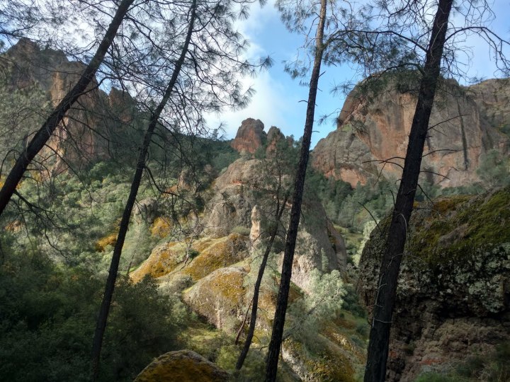
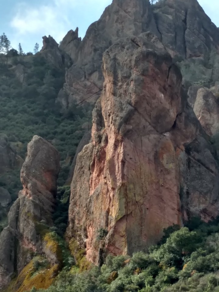
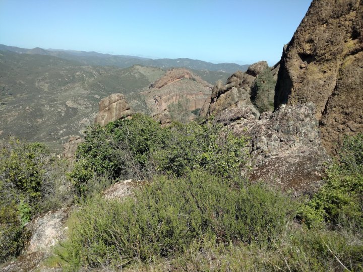
Pinnacles, named for volcanic rock formations millions of years old, is our most youthful national park, set aside in 2013. We saw the pinnacles up close and personal on the High Cliffs trail, which means I have no pictures of those. The path on that trail was steep and rocky, with squeeze-under, squeeze-through, steep-climb, and clambering-required areas, though some had railings. Most had drop-offs. There was one high, narrow bridge, always a favorite for the elevation-challenged.
I felt the need to stow my phone.
Pinnacles is one of two settings for the recovering California condor. One posed on a rock, exhibiting stunning detail of skin and feathers through the ranger’s spotting scope. Mostly they would soar, rising on thermals, or glide, falling with still wings, so we viewed their striking markings from above and below. I learned these bird terms post-trip.
G. californianus is also found in Big Sur. A scenery-appreciating vulture?
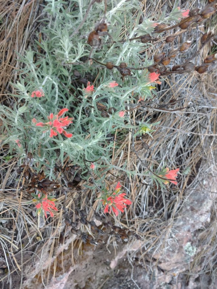
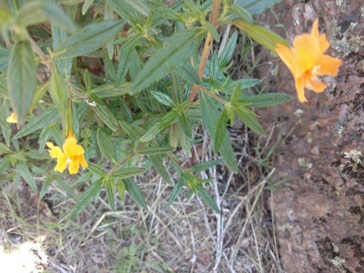
In the spring, Pinnacles is known for wildflowers, with the gloriousness of the display varying with temperature and the amount of winter rain. The most common wildflowers were purple, so I kept putting off taking a picture until I forgot. Here are two I did capture. The yellow ones, Sticky Monkey, have sticky leaves.
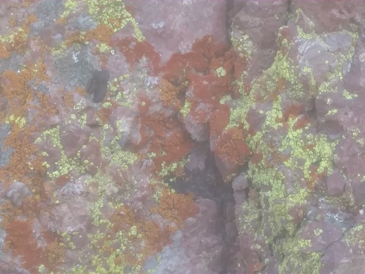
We also saw lichens, each a symbiont between a fungus and an alga. I once found it incredible that organisms from two domains, Eukarya and Bacteria, could combine so closely, but since I began studying the human microbiome, I’ve realized cross-domain partnerships are Nature’s norm.
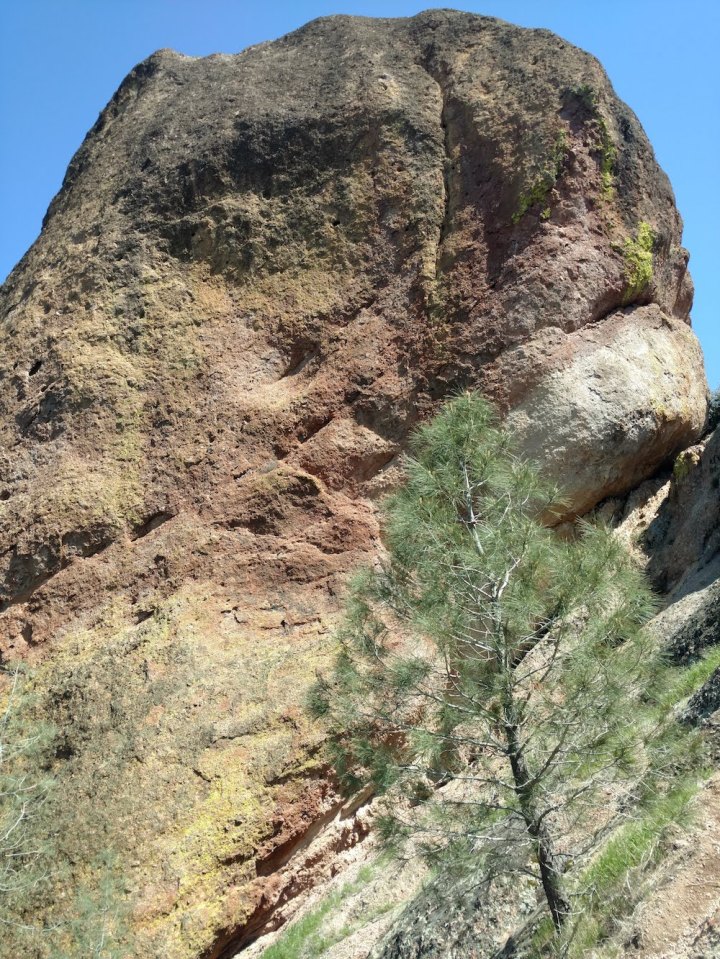
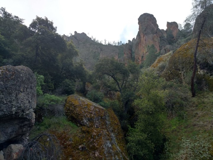
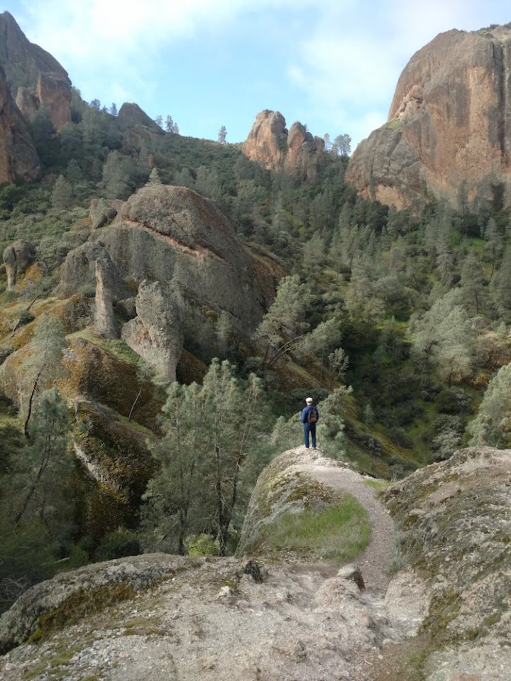
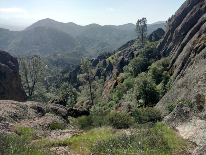
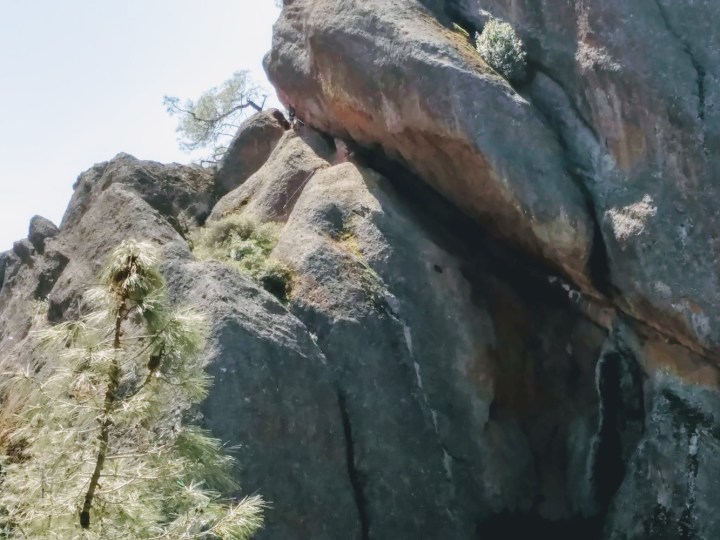
We spent 3 miles of the 4.3-mile trip traversing Juniper Canyon on the way to and from the pinnacles, and I did take some pictures! The canyon includes many Enormous Boulders, Strewn About. One shot includes a person, yet doesn’t really convey the scale.
As you rise through the canyon toward Scout Peak, you feel you can see for hundreds of miles with virtually no sign of civilization. No cell phone towers. Few roads. Not even planes.
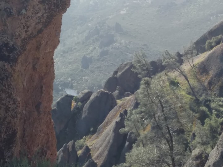
The small gray area just above a rock in the left middle of this picture is 215-million gallon Bear Gulch reservoir, as seen from Scout Peak, 4X magnification.
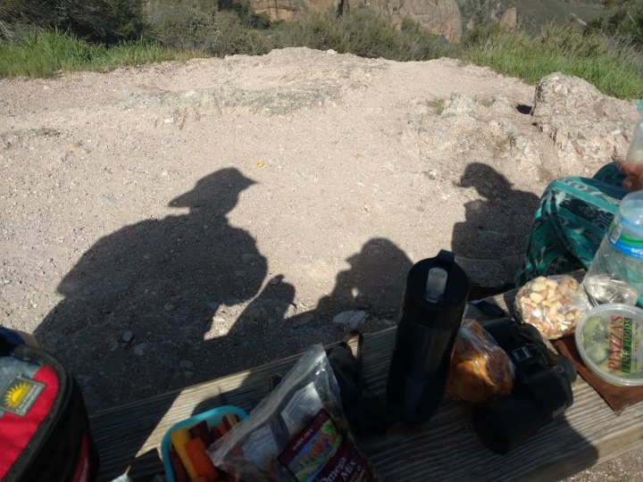
At Scout Peak, about halfway, we had a picnic. The scary part was in our future then.
On the way back, we saw a boulder that looked folded, perhaps from water erosion.
The round trip took about four hours. Extended physical exertion in a wild, remote area is amazingly rejuvenating. I’m absolutely the first person to say that. We earned our time in the hot tub last night, not to mention over 21,000 Fitbit points.
